Length:
2 or 3 days
Skill Level:
Beginner
Max Guide Ratio:
4:1
Recommended Season:
All year
Prior Trip Suggestions:
Old Town Quito & Teleferiqo,
Pasochoa
Follow Up Programs:
Antisana
Trip Highlights:
Solitude of a less frequently climbed mountain.
Fantastic bird watching opportunities.
Spectacular views of the cloud forest and nearby volcanoes.
Sincholagua
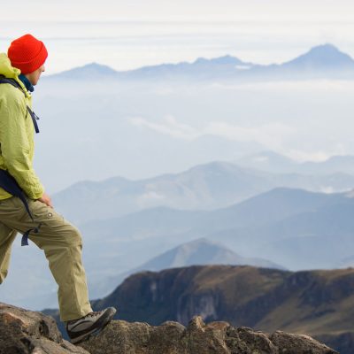
is an extinct volcano located 28 miles (45 km) southeast of Quito, on the northeast border of the Cotopaxi National Park. The climb up Sincholagua (16,053 ft/ 4.893 m) is mostly a scramble, and the access is more limited than other peaks in Ecuador. This makes it a less frequently climbed mountain, but those who make the effort to get to Sincholagua will be rewarded with a quiet acclimatization climb and spectacular views of the cloud forest and nearby volcanoes. Along the route there are breathtaking views of Cotopaxi, Ilinizas, Antisana, Rumiñahui, and the back side of Pasochoa. We may also be able to spot caracaras, falcons, eagles and the king of the Andes sky, the condor.
Its highest peaks are eroded chimneys, all that remains after the volcanic activity in 1877 and earlier. These are almost impossible to climb, as the scree just below the summit pinnacle is loose and the erosional forces on the chimneys have left mostly rotten rocks. We will climb the northwest route to a location just below the highest summits. This route was the same path taken on the first ascent of this peak in 1880 by Edward Whymper and the Carrels, however when they climbed Sincholagua it was still a well-glaciated mountain.
We will learn about the area’s natural history at the Mariscal Sucre Museum, the park visitor center. Here there is a 3-D model of the park and informative displays about the volcanic activity at Cotopaxi. The hikes around this area are great for bird watching, and visitors are often able to spot a herd of wild horses or lamas roaming along the Limpio Pungo Plateau.
photo gallery
trip itinerary
Day 1:
We will drive to Cotopaxi National Park. Then stop at the visitor center and hike around the Limpiopungo Plateau. Then we drive to the base of Sincholagua and set up camp (12,939 ft/ 3.944 m).
Note If you are connecting to this trip from the Rumiñahui climb, you will follow this Itinerary starting with Day 2.
Day 2:
After breakfast we begin our hike up the mountain. During the first hour and a half, we will pass through a series of pine groves and meadows. Then we will hike along a rocky ridge, to a traverse up the northwest face. The final ascent is exposed and requires some scrambling. At the top we have lunch and then hike out.
Want something even more challenging? On request, we can arrange a trip up the more demanding and technical climbing routes, such as the Pico Hoeneisen.
Note:
Every effort will be made to adhere to the itinerary, but unforeseen circumstances may require last minute changes. Weather conditions, road conditions, vehicle breakdowns and the health of climbers can all contribute to schedule alterations. Please be prepared to be flexible when necessary.


