Length:
1 or 3 days
Skill Level:
Beginner
Max Guide Ratio:
4:1
Recommended Season:
All year
Prior Trip Suggestions:
Old Town Quito & Teleferiqo
Follow Up Programs:
Sincholagua,
Cotopaxi
Trip Highlights:
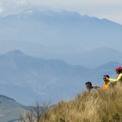
Great views of the nearby peaks and the valleys below.
You can observe the stark difference in vegetation from the eastern basin to the western basin of preserved forest.
Pasochoa
Pasochoa is located 19 miles (30 km) south of Quito. Its last eruption was during the most recent ice age, resulting in the collapse of the west side of its crater. This created a horseshoe shaped caldera which is still present today, although it has been heavily eroded over time. The hike to the summit (13,776 ft/ 4.199 m) is fairly straightforward, and not very steep. We will take the most direct route up the mountain, the Canal Rio Pita route.
At the summit we will have great views of the nearby peaks and can observe the stark difference in vegetation between the valley to the east and the western basin of preserved forest. The forest that fills the collapsed mountain crater on the western side of Pasochoa is a national forest reserve that was established in 1982. It is one of the last areas in the Sierras with intact native humid Andes forest. The humid Andes forest once covered the whole Quito basin, but overtime was converted to other land uses. This forest remnant was never settled for agriculture, because of its rugged topography. This helped preserve the area’s unique natural characteristics, plant and animal communities.
For those interested in climbing another nearby acclimatization peak, we recommend an extension that will link up to the Rumiñahui climb. On this extension we will travel from the base of Pasochoa to the base-camp of Rumiñahui. Along this beautiful hike, we will travel through stretches of humid Andean forest, where the observant explorer can spot one of the many species of hummingbirds that inhabit this landscape. As we approach Rumiñahui, the landscape transitions to the open páramo. Here we can enjoy the views of the surrounding four volcanoes: Cotopaxi, Sincholagua, Pasachoa and Rumiñahui.
photo gallery
trip itinerary
Day 1:
Drive 2 hours to the trailhead on the north side of Pasochoa. We will hike through pastures, then into páramo to the summit. Here we will enjoy our lunch and the views, then hike down. The hike to the summit will take 3 to 4 hours, with a shorter descent. Then drive back to Quito.
Rumiñahui Extension:
Note: If you are adding on the extension, we hike towards Pita River to establish our camp at Hacienda Santa Rita 3.280 m/10,761 ft.
Day 2:
After breakfast, we will hike from the base of Pasochoa to the basecamp at Rumiñahui.
Day 3:
Refer to the Rumiñahui itinerary.
Note:
Every effort will be made to adhere to the itinerary, but unforeseen circumstances may require last minute changes. Weather conditions, road conditions, vehicle breakdowns and the health of climbers can all contribute to schedule alterations. Please be prepared to be flexible when necessary.


